Services
City Supervision | Eco-Protection | Emergency Response | Business Services
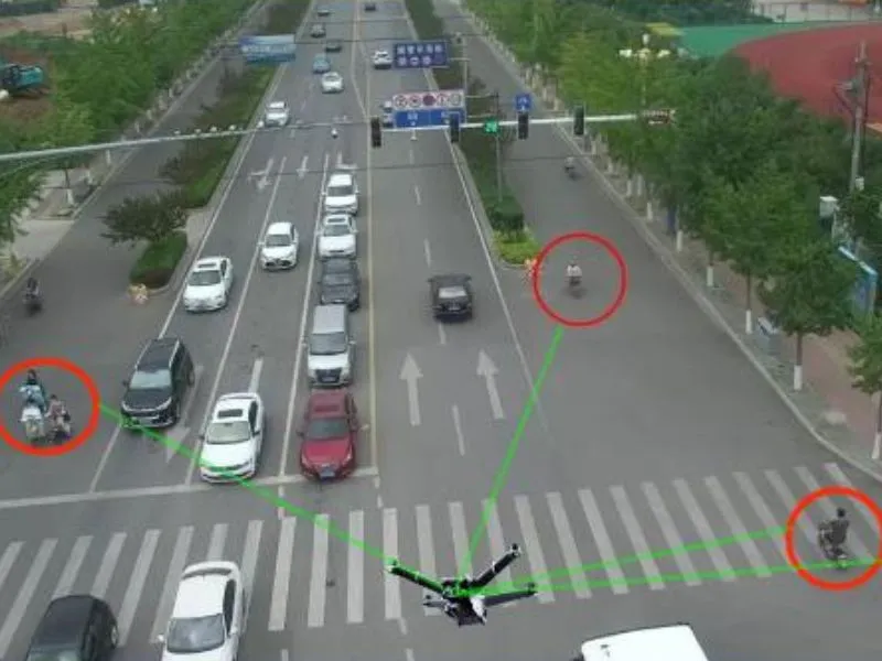
traffic patrol
Relying on the drone aerial inspection and intelligent monitoring technology, to build an all-weather, all-road traffic situational awareness network. These drones are equipped with high-definition optical cameras, infrared night-vision equipment and AI intelligent recognition system, capable of capturing real-time road traffic flow, vehicle traffic under complex road conditions and different weather conditions....
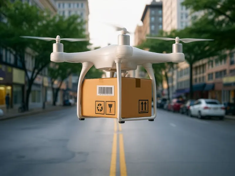
Logistics Express Transportation
Relying on the intelligent scheduling and precise distribution technology of drones, the company has built an efficient, flexible air logistics transportation network covering both urban and rural areas. These logistics drones are equipped with high-precision GPS positioning system, intelligent obstacle avoidance radar, automatic loading and unloading robotic arm and temperature-controlled cargo warehouse and other advanced equipment, and can be used in complex urban environments, mountainous areas...
border patrol
China has a total of about 22,000 kilometers of land borders, respectively, with 14 countries, of which 2/3 of the border line is the high mountains and deserts, in response to the high flow of people entering and exiting China's borders, smuggling and smuggling and other serious criminal activities, objectively requires the border departments to carry out the task of the long distance, the speed of response. ...
Agroforestry monitoring
The use of UAV-mounted multispectral cameras to monitor the nutritional status or disease chamber of vegetation (including crops, pastures and forests, etc.) has its advantages. Constructing a full set of UAV-mounted multispectral camera and data processing system can contribute to the informatization and modernization of agricultural plant protection. In particular, providing timely and accurate...
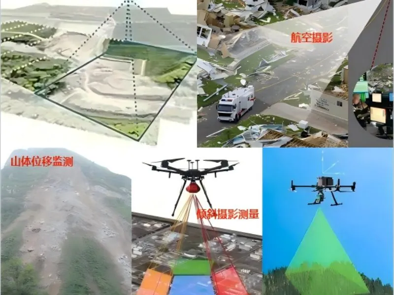
UAV aerial survey
Focusing on the fields of water conservancy project monitoring, environmental protection and emergency disaster relief, it obtains real-time image data through high-precision aerial photography to provide decision support for water resources management and disaster assessment. Combined with the cloud platform data processing technology, it realizes the automation of the whole process from data acquisition to analysis, and significantly improves the monitoring efficiency and accuracy. The...
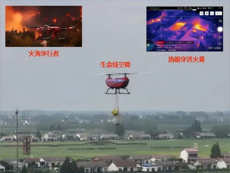
fire-fighting emergency
Based on the existing advantages of aviation, communications and information technology, to create a set of real-time fire reconnaissance, hotspot monitoring and disaster assessment in one of the aerial emergency monitoring system, able to provide accurate fire information and dynamic analysis at the scene of the fire, to provide a reliable basis for command and decision-making.
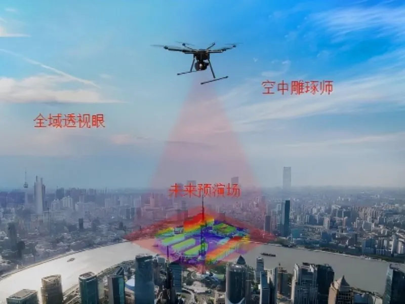
Urban 3D modeling
Using the drone platform to carry high-precision cameras to obtain the city's real-world image data, and generating high-precision, high-realism city digital twin models through professional 3D modeling software processing, providing intuitive visualization decision-making support for smart city planning, emergency management and urban governance.
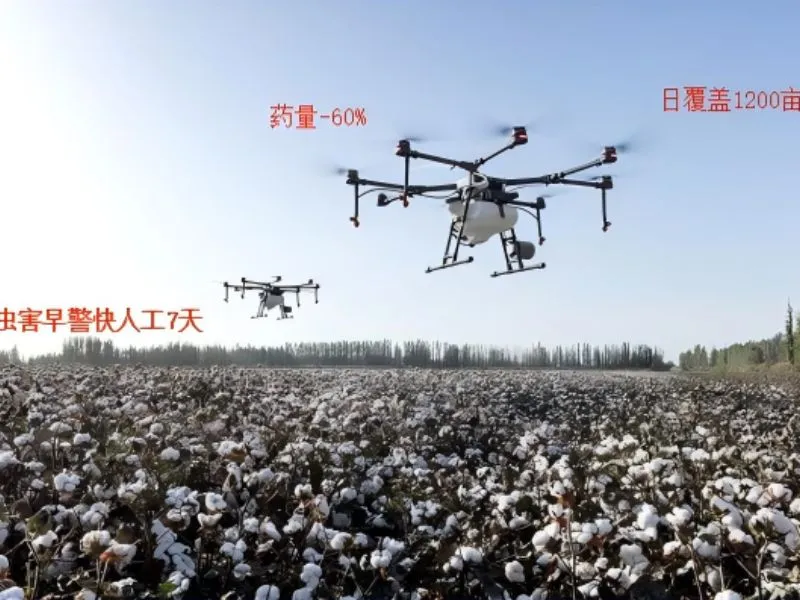
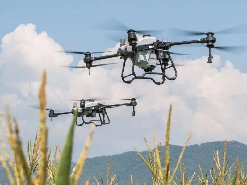
crop defense by flight
With the help of advanced spraying technology and precise positioning system, it can quickly implement pesticide and fertilizer spraying operations in large agricultural fields, significantly improving operational efficiency and reducing labor intensity. Through intelligent route planning and precise spraying control, the program can reduce the amount of pesticide use, reduce environmental pollution, and at the same time protect the health of crops...
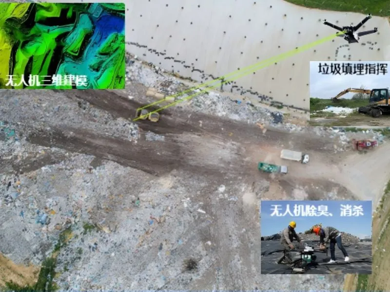
Landfill monitoring
Utilizing drones equipped with multispectral cameras and gas sensors, real-time monitoring of landfill leakage, gas emissions and cover layer integrity, providing high-precision three-dimensional modeling and thermal imaging maps, and effectively solving the problems of traditional manual monitoring that are difficult to reach and comprehensively cover.
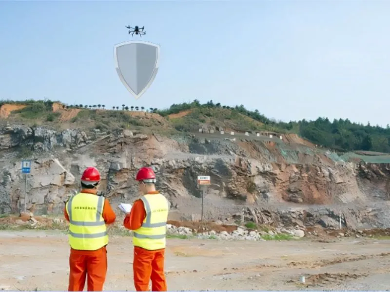
Mine site monitoring
Utilizing the real-time image transmission and efficient reconnaissance capability of UAS, it provides all-round, low-cost and efficient monitoring solutions in the fields of mine safety monitoring, environmental assessment, topographic mapping and disaster early warning, and significantly improves the level of mine safety management and emergency response capability.
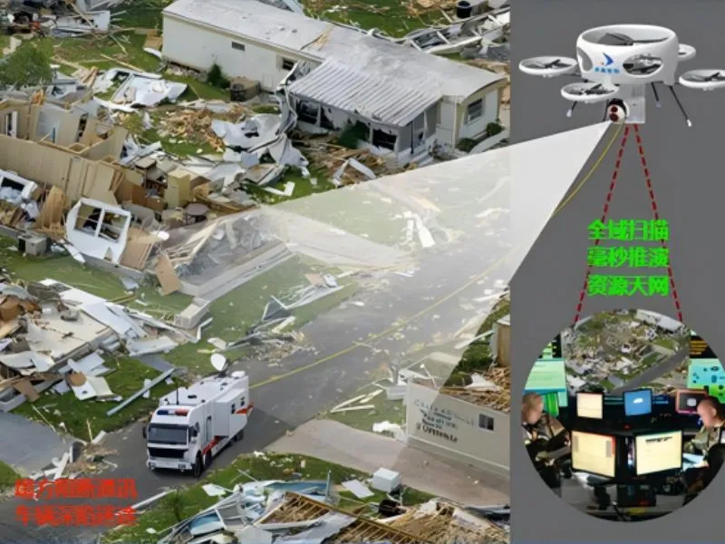
command of disaster relief
Constructing a disaster monitoring and command platform based on UAS, providing efficient and accurate situational awareness and decision-making support for emergency rescue through real-time image transmission, AI intelligent analysis and multi-source data fusion, and realizing the intelligent management of rapid survey, rescue route planning and resource deployment in disaster areas.
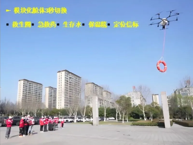
Relief Material Drop-off
Based on the unmanned aircraft system of Zhongxin Hangtronics, a rescue material UAV solution integrating real-time image transmission, precise positioning and automatic delivery is proposed, which can realize rapid response and precise delivery of rescue materials such as medical supplies, food and communication equipment in natural disasters and emergency rescue scenarios, effectively overcoming the terrain barriers...