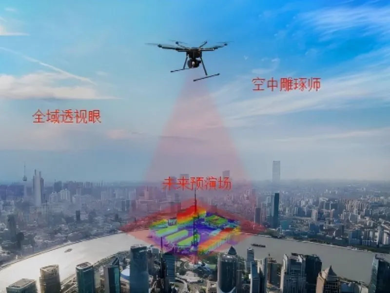
Urban 3D modeling
Using the drone platform to carry high-precision cameras to obtain the city's real-world image data, and through professional 3D modeling software [...]
Urban 3D modeling Learn more "
Using the drone platform to carry high-precision cameras to obtain the city's real-world image data, and through professional 3D modeling software [...]
Urban 3D modeling Learn more "
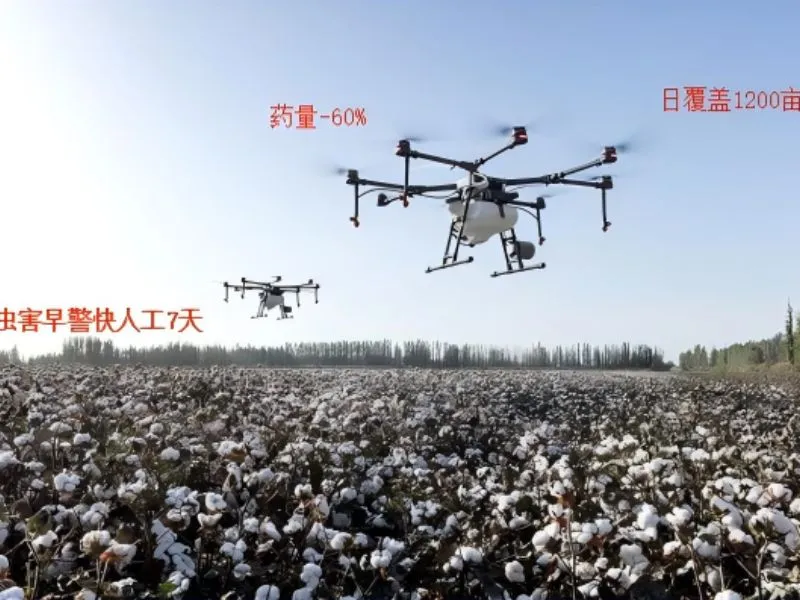
With the help of advanced spraying technology and precise positioning system, it is able to implement pesticide and fertilizer spraying quickly in a large area of farmland.
crop defense by flight Learn more "
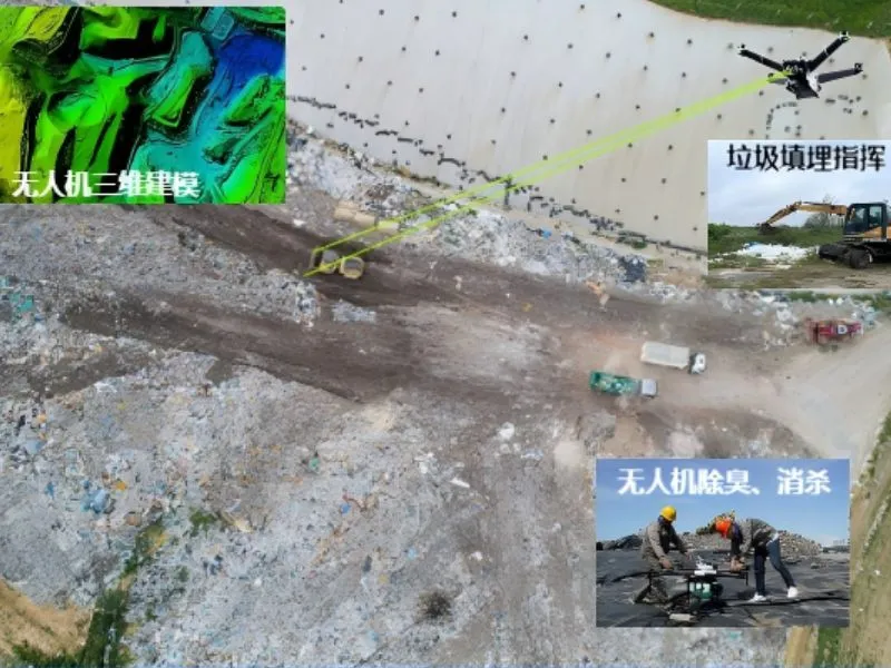
Utilizing drones with multi-spectral cameras and gas sensors to monitor landfill leakage, gas emissions and cover in real time.
Landfill monitoring Learn more "
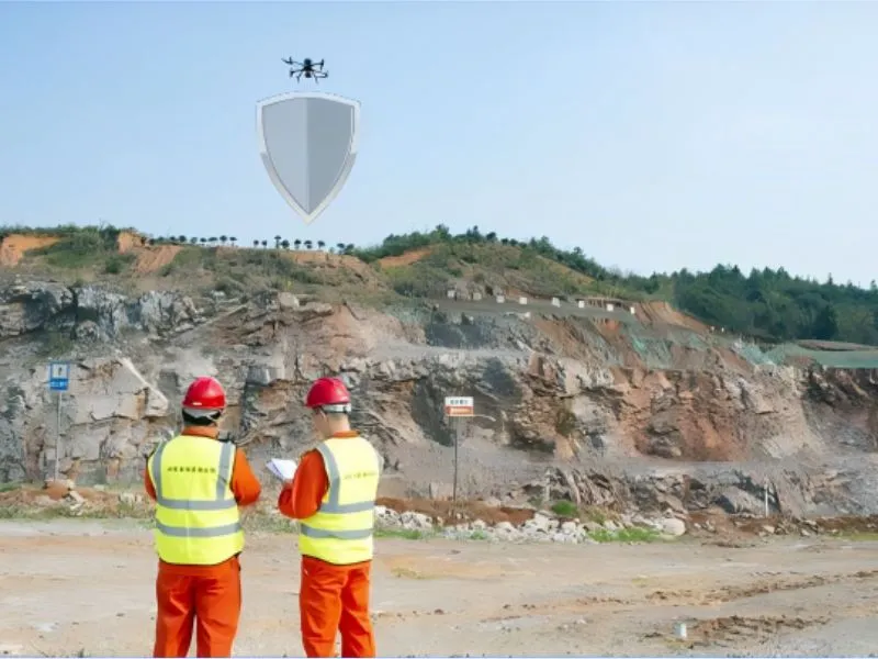
Utilizing the real-time image transmission and efficient reconnaissance capabilities of UAS in mine safety monitoring and environmental assessment,
Mine site monitoring Learn more "
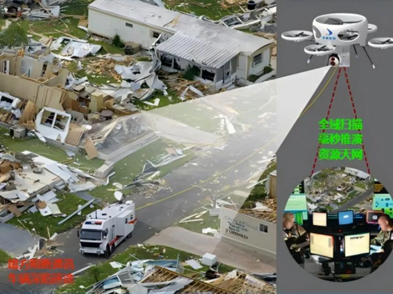
Construct a disaster monitoring and command platform based on UAS, through real-time image transmission, AI intelligent analysis
command of disaster relief Learn more "
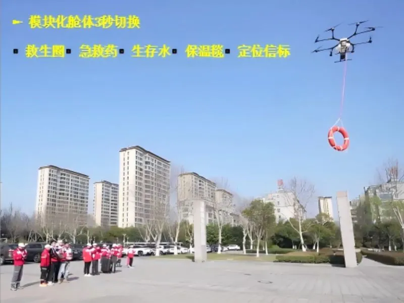
Based on the unmanned aircraft system of Zhongxin Hangtronics, we propose an integrated real-time image transmission, precise positioning and automatic launching system.
Relief Material Drop-off Learn more "