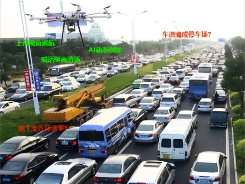
traffic guidance
Traffic guidance UAS utilize aerial perspective, real-time communications and intelligent algorithms to be able to navigate through traffic congestion, incident [...]
Traffic guidance UAS utilize aerial perspective, real-time communications and intelligent algorithms to be able to navigate through traffic congestion, incident [...]
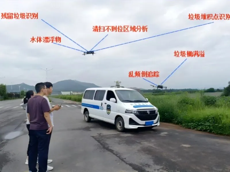
Utilizing the real-time image transmission and efficient inspection capability of the UAS to conduct all-round monitoring of the sanitation operation area
Quality inspection of sanitation operations Learn more "
UAS utilize aeronautical technology, network information technology, communication technology and 3S (remote sensing, geographic information system).
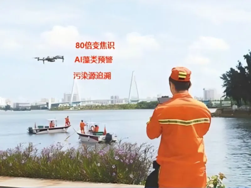
River floatation monitoring Learn more "
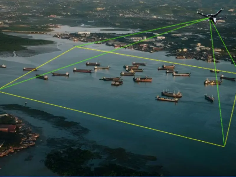
Combining high-precision imaging equipment and intelligent flight systems to provide water conservancy project monitoring, urban planning, and disaster assessment.
aerial photography Learn more "
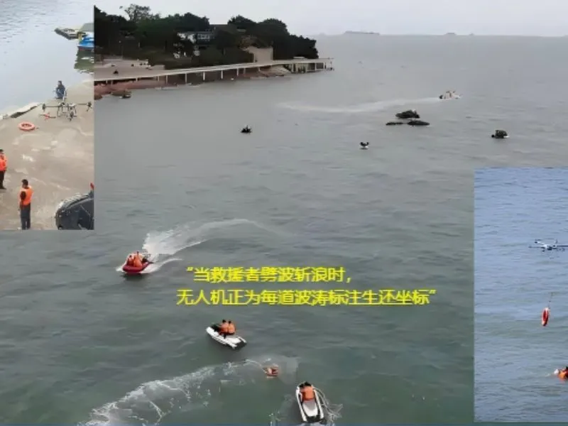
Combining high-definition image transmission technology with an intelligent identification system, it can quickly locate people overboard and throw them into the water under rough sea conditions.
It will play a key role in sea monitoring, ship control and emergency response. Utilizing high-definition aerial photography and real-time