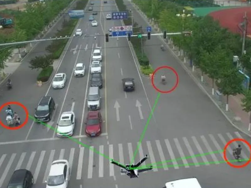
Drone mapping has a high advantage in realism, and the use of aerial drones can be a good solution to the problems that arise in strip mapping projects when carrying out topographic mapping in strip terrain areas.
Drone mapping has a high advantage in realism, and the use of aerial drones can be a good solution to the problems that arise in strip mapping projects when carrying out topographic mapping in strip terrain areas.