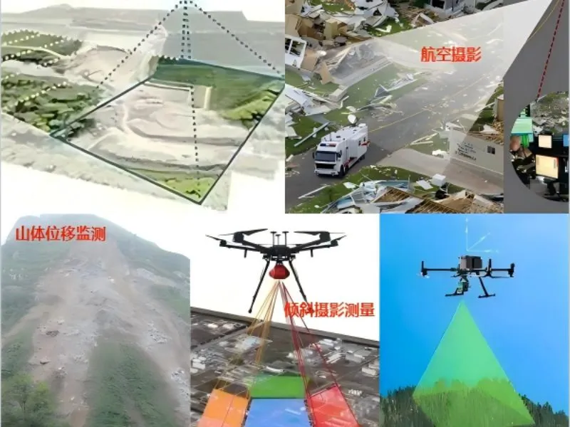
Focusing on the fields of water conservancy project monitoring, environmental protection and emergency disaster relief, it obtains real-time image data through high-precision aerial photography to provide decision support for water resources management and disaster assessment. Combined with the cloud platform data processing technology, it realizes the automation of the whole process from data acquisition to analysis, significantly improving the monitoring efficiency and accuracy. The program is especially suitable for inspections and assessments in complex terrain areas, which can effectively reduce labor costs and improve operational safety.