Services
City Supervision | Eco-Protection | Emergency Response | Business Services
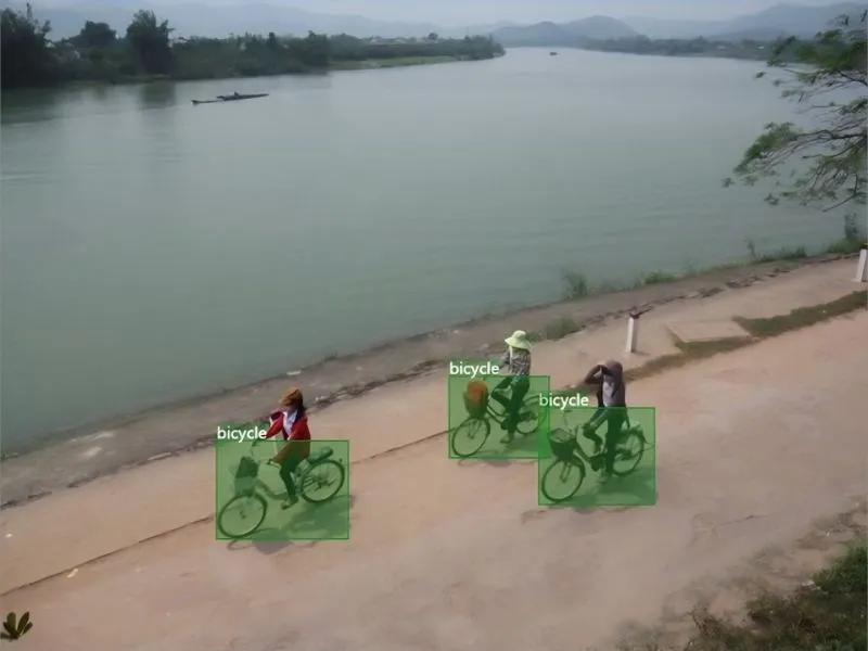
Non-Motorized Vehicle Trespass Recognition
By deploying high-definition cameras and AI visual recognition systems, it monitors non-motorized vehicle violations on roads and prohibited areas in real time. The solution utilizes the flexibility and wide-area coverage advantages of drones, which can record the evidence of illegally trespassing non-motorized vehicles and link with the traffic management system to improve the efficiency of urban traffic safety management...
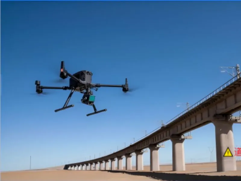
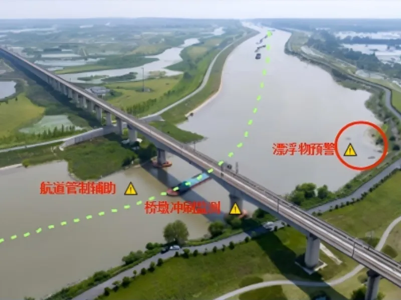
Road and Bridge Inspection
Combined with high-definition image acquisition and real-time transmission technology, the system can carry out all-round inspection of bridges and road structures, and quickly identify cracks, deformations and other potential safety hazards. The system has the ability of all-weather operation, which can effectively reduce the risk of manual inspection, and at the same time improve the accuracy and efficiency of inspection, and provide timely and reliable data for road and bridge safety management....
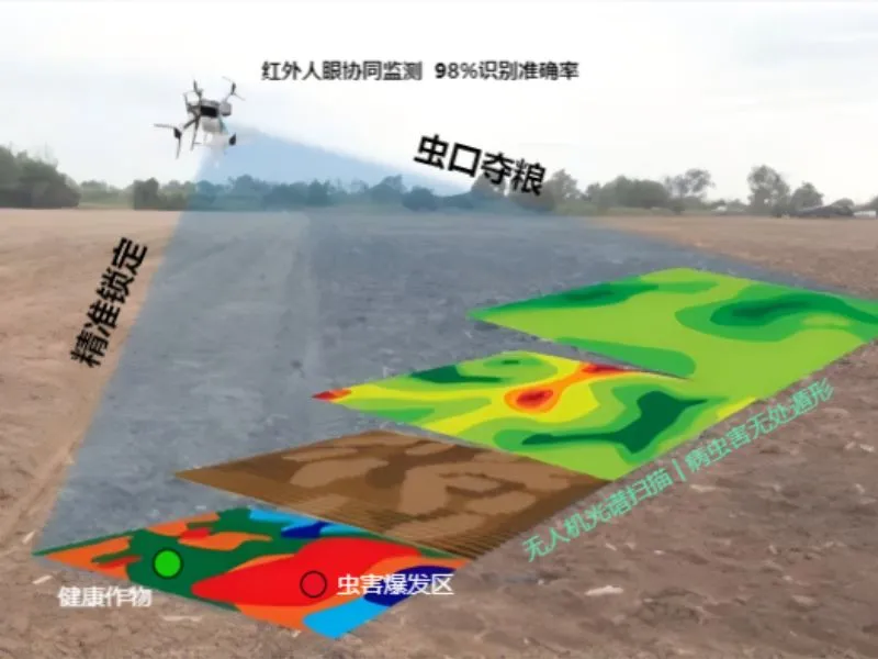
Pest and disease monitoring
By carrying high-definition cameras and multi-spectral sensors, it can quickly scan agricultural and forestry areas, identify abnormal vegetation changes, and transmit real-time geographic location and image data of pests and diseases, so as to provide scientific basis for precise application of medicine and timely control. The system is characterized by wide coverage, high monitoring efficiency and accurate data analysis, and can...
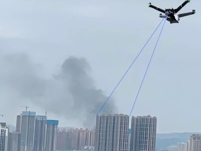
Urban fire inspections
The urban fire inspection drone live application program combines aviation and AI technologies to realize real-time reconnaissance, hotspot monitoring, hidden danger investigation and emergency command of urban fire risk areas, and to improve the fire department's capability of early warning, monitoring, and emergency response to fires.
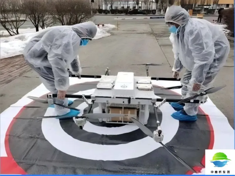
Medical equipment and pharmaceutical distribution
The medical equipment and medicine distribution drone program utilizes drone technology to realize rapid distribution of medical supplies in remote areas, disaster sites or areas with traffic obstruction, with all-weather operation capability, remote control function and real-time cargo monitoring system, which can significantly enhance the speed of medical emergency response and treatment efficiency.
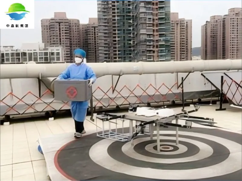
Specimen distribution
The specimen distribution drone application solution realizes fast and safe distribution of medical specimens by integrating aviation technology and information system, effectively solving the problems of traffic congestion and distribution in remote areas, significantly improving medical efficiency and reducing manpower costs.
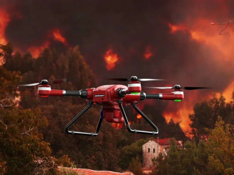
forest fire prevention
Relying on UAV aerial inspection and intelligent monitoring technology, an all-weather, all-round forest fire monitoring network has been constructed. Equipped with high-precision thermal imaging sensors, high-definition optical cameras and intelligent algorithm systems, these drones are able to capture real-time temperature changes in forest areas under complex terrain and bad weather conditions, smoke...
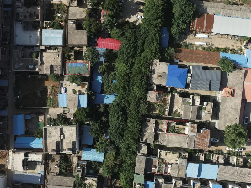
Control of illegal construction
The use of drones for high-altitude inspection and intelligent image comparison, timely detection, forensics and monitoring of illegal construction behavior, to provide urban planning and law enforcement departments with accurate and efficient means of control, and help standardize and intellectualize urban governance.
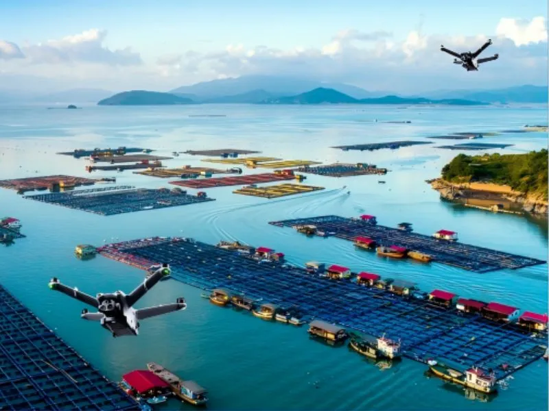
water body patrol
Utilizing advanced drone technology and intelligent monitoring systems, we provide a full range of intelligent monitoring solutions for rivers, lakes, reservoirs, coastlines and other water bodies, helping our customers to realize precise management of the water environment, rapid identification of pollution sources and effective protection of water resources.

environmental protection
Utilizing the real-time monitoring capability of the UAS, environmental indicators such as air quality, water pollution, forest coverage, etc. can be efficiently monitored and data collected. By carrying professional sensors and high-definition camera equipment, it can quickly identify the source of environmental pollution and provide decision-making basis for environmental protection departments. The program also supports regular patrol...
Forestry monitoring
Utilizing the advantages of aerial image acquisition technology and real-time transmission of UAVs, it provides all-round solutions for forest resources monitoring, forest fire monitoring and wildlife investigation. The system can efficiently identify abnormal situations in forest areas and realize dynamic supervision and change detection of forest resources. In forest fire early warning and fighting command...
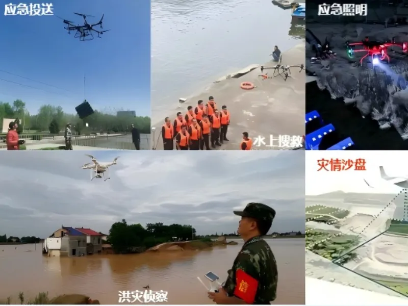
emergency relief
Applicable to natural disasters, urban public security incidents, mountain rescue, water search and rescue and other emergency scenarios, can effectively make up for the shortcomings of the traditional means of rescue, enhance the scientific and technological content of emergency rescue and rescue efficiency.